Historically Low Snowpack in the Southern Rockies and its Effects on the Arid Southwest
Matthew Scribner • April 15, 2025

Drought on Arrival: The Southwest’s Grim 2025 Outlook

Introduction


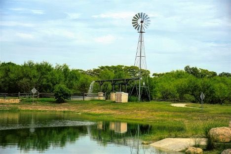
The Southern Rocky Mountains, particularly the Sangre De Cristo mountain range in New Mexico, is suffering through an abysmal winter. While El Niño years have historically favored a deeper snowpack for more northern and coastal regions, such as the Cascades and Northern Rockies, this year has been particularly rough for the southern reaches of North America’s largest mountain range. As of March 13th, 2025, Opensnow data currently shows that the snowpack for Taos, the largest ski resort in New Mexico, sits at 26% of average. While this figure is certainly disappointing for skiers in the region, the implications of this reach much further than outdoor recreation. The American Southwest heavily depends on the water that melts from the yearly winter snowpack for drinking water, irrigation, and a plethora of other uses. With almost one quarter of the average snow melt available for beneficial use, the prior appropriation system of this region is set to experience the most difficulty it has had in years in ensuring that water rights holders receive their yearly allocation.


The Severity of the Situation


To fully understand the severity of the lack of snow this region has experienced during the 2024-25 winter, some additional figures and statistics are required. Snow Telemetry (SNOTEL) snow water equivalent (SWE) values show that New Mexico’s eight basins sit at 0%, 5%, 19%, 21%, 23%, 25%, 37%, and 58% of the 1991-2020 median. Further, The Durango Herald opines that the temperature of the region has consistently sat at 11-22 degrees Fahrenheit above average this winter. This figure is in line with a claim by Tony Bergantino, the director at the Wyoming State Climate office, who stated that New Mexico had its warmest October-December since 1895. Not only does this provide evidence of far less snowfall, but it also shows that the snow that has fallen has melted and flown downstream much earlier than it normally would. This reality has proven to be significantly impactful to reservoirs across the state of New Mexico as well. A report published by the Natural Resources Conservation Service on March 1 shows that the reservoirs in the Lower Rio Grande, Rio Chama-Upper Rio Grande, and Pecos basins sit at 11%, 10%, and 7%, respectively. The report also discusses the forecasted streamflow volumes in relation to the 1991-2020 median. These figures are equally as abysmal, as the Lower Rio Grande, Zuni, Gila-San Francisco, Pecos, and Rio Chama-Upper Rio Grande Basins are projected to be at 4%, 22%, 35%, 36%, and 39%, respectively this spring and summer. All these statistics paint a picture of a scary reality regarding the availability of water across the American Southwest in 2025, with many of these figures providing evidence of record-breaking drought conditions that will have countless ripple effects on humans, wildlife, and the landscape of the region.


Ancillary Effects


 While not directly related to water, this discussion could not take place without mentioning the impacts a drought of this severity will have on wildfires across the region. An article by Source NM states that even before spring has officially started, two red flag warnings have already been issued this year by the National Weather Service. The first warning was unbelievably issued on January 4, while the second came just over a month later, on February 5. This severe drought, combined with several other situational factors, has created a dire outlook regarding the potential impact that wildfires could have on the state throughout the rest of 2025. Another article by Source NM asserts that fine fuels, which provide the ability for blazes to grow rapidly, are abundant due to two consecutive years of plentiful precipitation preceding this historic drought. Plants like grass and pine trees were able to thrive under wet conditions over the last 24 months but have now become dry and easily ignitable due to the lack of recent rain and snowfall. An article by the Denver Post provides a bleak outlook for this situation, as dry and hot conditions are predicted to take hold over the coming spring months.  Biologically, this is the perfect storm for a fire season of epic proportions, a situation created largely by the abysmal winter this region of the United States has suffered through.

Unfortunately, the political situation we find ourselves in in the United States is set to exacerbate this situation even further. According to Source NM, the Department of Agriculture recently let go of 34,000 employees, and 75% of them were equipped with firefighting capabilities. Further, the same article states that two firefighting dispatching stations in some of the most fire-prone areas of New Mexico, including the Gila National Forest, have been shut down. Additionally, also highlighted by Source NM, President Trump’s decision to gut the probationary workforce and enact a temporary hiring freeze on seasonal employees across federal agencies such as the National Forest Service, Bureau of Land Management, and Department of the Interior limits the ability for the government to put up a fight when intense blazes inevitably break out. The West is clearly unprepared to handle what could be a historically destructive wildfire season headed for us in the coming months, as a potentially deadly combination of factors have combined to create a truly bleak outlook for the 2025 fire season.


Effects on the Prior Appropriation System


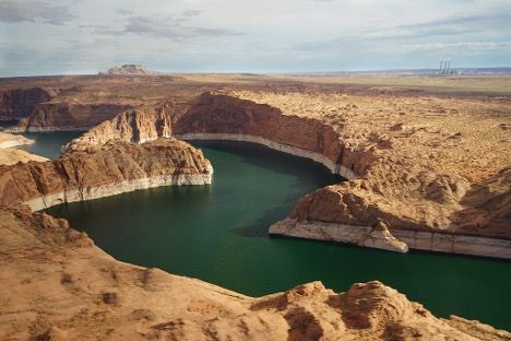
The extreme decline in water across New Mexico’s streams and reservoirs is set to impact the state’s prior appropriation system significantly. According to the Bureau of Reclamation, New Mexico is one of seven states reliant on the Colorado River for fresh water utilized for a variety of purposes, including irrigation, municipal, and commercial use. The Bureau of Reclamation further explains that New Mexico receives their allocation of Colorado River water via the San Juan-Chama project, which diverts water from the San Juan River, a major tributary of the Colorado River, to the Rio Grande Basin. This reality presents a difficult situation for not only New Mexico, but also the states of Colorado, Wyoming, Arizona, Nevada, Utah, Arizona, various Native American tribes across the region, and Mexico, as they all rely on the Colorado River to supply this arid region with such a valuable resource.


New Mexico is no stranger to drought, so they have implemented measures to prepare for bad winters, such as the one they have experienced in 2024-25. According to the Colorado Environmental Law Journal, New Mexico created the Strategic Water Reserve as a means of navigating interstate water agreements, such as the 1922 Colorado River Basin Compact that governs their allocation. This allows the state to appropriate funds to purchase additional water rights in times of shortage, such as right now. However, despite these preventative measures, New Mexico still finds themselves in a precarious position. The Colorado Environmental Law Journal further opines lower basin states like California still have superior bargaining power in times of drought because San Juan-Chama authorizing language states that New Mexico must take reductions of their Colorado River Basin to ensure that these states' senior rights are fulfilled. Considering this current drought has also substantially affected other southwestern states, like Arizona and Nevada, this places New Mexico in a precarious position. The primary tenant of the prior appropriation system, “first time in time, first in right”, creates a system where junior rights holders are simply not made whole in times when their inferior rights cannot be fulfilled.


New Mexico recognizes that this is an unfortunate reality the arid west must come to grips with, and developed a system called Priority Administration to address drought conditions under the prior appropriation system. The Utton Center states that under this system, the State Engineer holds a large amount of discretion as to how to curtail usage to adhere to current drought conditions. The process begins with the State Engineer identifying all the priority dates within a stream system. Then, a final list of all the water rights in the system is published, giving rights holders the chance to appeal the date associated with their right. Due to New Mexico’s agricultural history, many of the most senior rights in the system are held in extremely rural, agrarian areas. This pits them against large urban areas like Santa Fe and Albuquerque, creating a situation where the state may experience significant negative economic impacts if one of these senior rights holders places a priority call against a junior, urban rights holder. This reality highlights the significant difficulty states in the arid west have in dealing with a drought of these extreme proportions. While Priority Administration is a tool of last resort, the extreme figures described in the previous section point to a high likelihood of the system being implemented in 2025, creating a troubling outlook for the future of New Mexico’s water adjudication system.

 
Conclusion


It has become abundantly clear that New Mexico is in an extremely precarious position as we shift from winter to spring in 2025. Time is quickly running out for the region to experience a pattern shift that will result in a significant amount of snowfall. The state as a whole must begin preparing for what is looking to be one the driest years in recorded history. The effects on the state’s ability to ensure that rights holders receive their allocation will inevitably be affected greatly, as they will be forced to navigate some of the biggest strains the prior appropriation system has ever seen placed on it. The impacts of this drought will likely be exacerbated by a potentially historic fire system, which unfortunately requires even more water to mitigate potentially catastrophic damage to public lands and private property. 2025 is set to put the adequacy of the prior appropriation to the test, and as we navigate the increasingly impactful effects of climate change, it will be fascinating to see if this comprehensive system of water allocation will be able to keep up.


Sources


  • OpenSnow, Taos Snow Report,  https://opensnow.com/location/taos/snow-report, (last visited Mar. 13, 202).
  • U.S. Drought Monitor, Snow Drought: Current Conditions and Impacts in the West, Drought.gov (Mar. 6, 2025).
  • Danielle Prokop, New Mexico Snowpacks in the Red; Dry and Hot Weather Expected, The Durango Herald (Mar. 13, 2025).
  • Nat. Res. Conservation Serv., New Mexico Basin Water Supply Outlook Report, U.S. Dep’t of Agric. (Mar. 1, 2025).
  • Danielle Prokop, New Mexico Snowpacks in the Red; Dry and Hot Weather Expected, Source N.M. (Mar. 13, 2025).
  • Patrick Lohmann, 'It's Bad': How Drought, Lack of Snowpack and Federal Cuts Could Spell Wildfire Disaster, Source N.M. (Mar. 10, 2025).
  • Conrad Swanson, Drought, Fire and Climate Change Put the West—and New Mexico—at Risk, Denver Post (Mar. 11, 2025).
  • U.S. Bureau of Reclamation, Colorado River Basin, U.S. Dep’t of the Interior (last visited Mar. 13, 2025).
  • U.S. Bureau of Reclamation, Upper Colorado River Basin Projects, U.S. Dep’t of the Interior (last visited Mar. 13, 2025).
  • Katherine H. Tara & John Fleck, Water Rights and Environmental Justice in the West, Ctr. For Env’t L. & Justice.
  • Utton Transboundary Resources Ctr., Priority Administration of Water Rights, Univ. Of New Mexico.


By Lexi Kay LeCroy April 25, 2026
Benjamin Franklin once said, “When the well is dry, we’ll know the worth of water.” Unsurprisingly, the precious resource he acknowledged is the same one that people fought and died over. While violent disputes used to provide the typical means to acquire water rights, states since then regulated water ownership in a manner suitable to their geographical location and purposes. Texas and Colorado take their own respective approaches to statutory regulations, particularly when focusing on aquifers. This article compares how Texas Groundwater Conservation Districts and Colorado Ground Water Management Districts regulate aquifer mining and depletion. Both states base their controlling schemes over water rights on the legal principle of “first in time, first in right.” However, Colorado assumed the Prior Appropriation Doctrine, Texas took on a hybrid version—the Rule of Capture. The Texas Legislature refining regulatory bodies governed mainly by said separate entities created by the state legislature supersedes the Rule of Capture. The Rule of Capture’s remnants remain in some of the current governing rules in Texas. Meanwhile, Colorado remains steadfast in its application of Prior Appropriation. Despite having different approaches, Texas and Colorado both created Groundwater Conservation Districts to manage areas statewide with little to no water. This blog focuses specifically on those districts and the statutory foundations upon which they rest. Regardless of the statewide structure governing water rights, both states share similar policy goals. In the face of environmental concerns, such as subsidence and the resulting evolving geological areas, both Texas and Colorado must address the ever-growing need for more water, both in and out of aquifers. I. State Approaches to Aquifer Regulation And Well Spacing A. Texas Groundwater Conservation Districts After the U.S. Constitution and federal laws, the Texas Legislature holds the ultimate authority to enact laws governing water rights and management. It delegates specific powers to state agencies and local entities to implement and enforce the Texas Water Code through the Texas Commission on Environmental Quality (TCEQ). The genuine “boots on the ground” enforcers specific to groundwater management are Groundwater Conservation Districts (GCDs). Texas granted GCDs the authority to regulate well spacing and groundwater production. Statutorily, these GCDs remain the state’s preferred method of groundwater management to preserve property rights across Texas while balancing conservation and development concerns; however, the state not always prioritizes considerations of conservation and development. Historically, Texas followed the Rule of Capture, which allows a landowner to pump water from beneath his or her property, even at the expense of his or her neighbor. The rule established in 1904 by the Texas Supreme Court in Houston & T.C. Ry. V. East, which held that a landowner had no legal remedy against a railroad company that had moved next door and drilled a larger well, causing the landowner’s well to go dry. The court’s simple solution for the landowner: drill a bigger, deeper well than the railroad. Over time, establishing GCDs addressed specific policy concerns and granted regulatory authority over groundwater. To simplify, Texas state law sets the framework; TCEQ rules govern broad permits and quality; and the GCDs manage groundwater production, depletion, and protection. It is interesting to note that, under Texas law, tributary groundwater is not defined separately from non-tributary groundwater. Instead, the statute creates two primary categories of water: surface water and groundwater. The primary focus centers more on each GCD’s ability to adopt rules suitable for each aquifer, subdivision of an aquifer, or geographic area overlying aquifer boundaries. This can account for the unique characteristics of each aquifer, especially when considering the varying climates across the state, as well as to categorize the aquifer’s physical attributes—i.e., what Colorado distinguishes as tributary or non-tributary. GCDs combine the physical characteristics of an aquifer with defining the “ best available science ” to combat issues that may arise. This boils down to utilizing “conclusions that are logically and reasonably derived using statistical or quantitative data, techniques, analyses, and studies that are publicly available to reviewing scientists and can be employed to address a specific question.” The relevant question that arises from this statutory line of thinking is this: Is the reliance on scientific methods too exclusionary of relevant human interests? There seems to be a fine line. While science remains a strong method for determining relevant environmental concerns, it is not always kind to the economic and personal interests of smaller parties, such as farmers and ranchers living in rural areas. B. Colorado Ground Water Management Districts As the state that first developed and implemented the Prior Appropriation Doctrine, Colorado remains known for its water courts and precedent governing all rights to water. The Prior Appropriation system dictates that appropriation occurs when someone removes water from a water source and then puts it to a beneficial use. The first person to take the water and put it to a beneficial use gains priority over subsequent appropriators, and once receiving a court decree verifying status, becomes a senior water right owner relative to subsequent appropriators. Senior owners’ priority over junior water right owners, with the underlying expectation that senior owners’ “call” for water fulfills before any other water owners. Notably, the Colorado Ground Water Management Act of 1965 (GMA) modified said Prior Appropriation system to prevent unreasonable aquifer depletion on Colorado’s Eastern Plains, where notably less water connects to surface streams. The GMA established the Colorado Ground Water Commission (GWC), which governs the Ground Water Management Districts (GWMDs). Both entities have jurisdiction over designated groundwater , which is statutorily distinct from tributary groundwater. Designated groundwater encompasses water located within designated basins that either (1) would not feed into decreed surface water rights, or (2) is in areas lacking a constant natural stream where groundwater serves as the primary water source for at least 15 years prior to the basin’s designation. Essentially, this boils down to water that provides a de minimus impact on surface streams. The GWC holds the authority to adjudicate designated groundwater rights only, as well as issue large capacity well permits. In contrast, the GWMDs represent local districts wherein there is more administrative power within their designated boundaries. GWMDs retain authority to regulate the use, control, and conservation of groundwater within their boundaries. GWMDs can adopt controls and regulations to minimize the lowering of the water table, subject to review and approval by the GWC. If anything, this specific governance over designated groundwater provides a balance of economic development with aquifer sustainability. II. Regulatory Mechanisms to Handle Drawdown & Depletion A. Texas Texas GCDs intend to regulate groundwater production to minimize aquifer drawdown, prevent subsidence, and protect water quality. To do this, GCDs can adopt rules to regulate well spacing to prevent well-to-well interference and reduce the depletion risk. GCDs can also limit groundwater production based on acreage and impose production limits to ensure sustainable aquifer use. GCDs consider a multitude of factors when implementing rules specific to drawdown and depletion regulation, including, but not limited to, hydrological conditions, recharge rates, and socioeconomic impacts, when estimating desired future conditions for aquifers. Further, Texas Water Code Chapter 36 grants GCDs discretion to regulate groundwater production to preserve historic or existing uses. The main workhorse provision for dealing with well-to-well interference and localized depletion focuses on district regulation of well spacing and production to prevent waste and the protection of groundwater reservoirs. Many GCD rules base production limits on acreage or tract size and impose minimum spacing between wells to reduce interference between cones of depression and avoid unreasonable impacts on existing wells. At the same time, other statutory requirements require most non-exempt wells to obtain permits, and districts must evaluate those well applications against their management plans and the regional “ desired future conditions .” Those desired future conditions essentially act as a statutory cap on how much depletion is acceptable in a particular aquifer. These implementations layer over the Rule of Capture, as well as case law, which push districts to balance their state-mandated code with potential takings claims when they limit pumping too aggressively. B. Colorado Colorado GWMDs, on the other hand, govern designated groundwater, and the aquifers they govern are already facing long-term depletion. Instead of the pure conservation mandate that Texas possesses, Colorado’s statutes primarily focus on preventing “unreasonable injury” or “material injury” to existing water rights, as laid out in specific well-permitting provisions. The Colorado Supreme Court previously interpreted these statutes to mean that prior appropriators are not entitled to a “frozen” water table; i.e., that some drawdown is statutorily allowed so long as it does not unreasonably impair earlier wells. Colorado’s permitting rules directly tie into well-to-well interference and aquifer mining. The GWC has to decide whether unappropriated groundwater is available and whether a proposed well will cause material injury to vested rights. It can deny or limit permits with conditions to follow if those standards are not met. In some situations, Colorado law requires augmentation or replacement plans, which provide means to replace depletions to avoid injury. Unlike Texas’s future conditions consideration, Colorado does not always aim to meet a specific target of drawdown; instead, the “unreasonable injury” and “material injury” language function as a legal limit for how much aquifer decline is tolerated within a designated basin. II. Challenges & Policy Considerations A. Comparison of the Challenges Each State Faces One of the biggest challenges that Texas must consider is that its framework sits on top of the old Rule of Capture background, while also telling GCDs that they are supposed to conserve and protect the water that landowners think they own. The Texas Water Code recognized that landowners have “ ownership of groundwater in place .” It then clarifies how that ownership is defined by stating that it is subject to “ regulation under this chapter and under the rules adopted by a district.” At the same time, another section lays out what seems like an ambitious policy: districts must provide for “the conservation, preservation, protection, recharging, and prevention of waste of groundwater and of groundwater reservoirs or their subdivisions, and to control subsidence caused by withdrawal of groundwater.” In other words, GCDs essentially respect private property rights but also keep aquifers from being mined and the land from sinking, which is a bit of a tightrope. Texas courts also added pressure by recognizing takings-like claims in groundwater regulation. The Texas Supreme Court previously acknowledged in Edwards Aquifer Authority v. Day that landowners possess a constitutionally protected interest in groundwater in place, and district regulations that go “too far” could potentially be held responsible for providing compensation. This could reasonably make a district nervous about utilizing the full extent of its statutory powers under provisions governing spacing and production, or even permitting, to really clamp down on drawdown and depletion. Thus, a district might actually be squeezed from three directions at once: landowners invoking precedent, regional desired future conditions that say “you can’t pump that much,” and a statutory conservation and subsidence mandate that doesn’t really create a clear safe harbor. It is not shocking that implementation looks uneven from district to district. Colorado’s challenges look a little different because the foundational system is Prior Appropriation, but many of the practical roadblocks are similar. The Colorado GMA creates the category of “designated groundwater” and puts it under the jurisdiction of the Colorado GWC and local GWMDs. While considering the plain language of the statute seems clarifying, in reality, figuring out what is designated versus tributary, and how much connection there is to streams, can be complicated and politically touchy. Additionally, the GMA assumes that some level of aquifer mining will occur and then tries to keep it within tolerable bounds, which, in theory, is logical. The GWC is supposed to issue large capacity well permits only when there is unappropriated groundwater and when existing rights won’t suffer substantial injury. As noted in Jaegar v. Colorado Ground Water Commission, the Colorado Supreme Court made it clear that prior appropriators in designated basins do not guarantee that the water table will stay where it was when they drilled; rather, the GMA protects from unjustified impairment. This gives the GWC and the local districts some flexibility, but also means that they must make controversial judgment calls about how much decline is too much. The Colorado Supreme Court also stressed that the GWC must weigh economic development and beneficial use against aquifer conditions when deciding whether additional wells are compatible with statutory standards. Thus, it seems that Colorado regulators constantly balance the statutory foundation of Prior Appropriation against the explicit decision in the GMA to allow planned depletion. B. Takeaways Each State Could Learn from The Other One obvious notion that Colorado might learn from Texas is how to be more explicit about conservation and subsidence in the text of the statutes. Texas regulations remain quite blunt in stating that GCDs exist to conserve and preserve groundwater, recharge aquifers, prevent waste, and “ control subsidence caused by withdrawal of groundwater.” That clear-cut statement of policy gives Texas districts a straightforward rule when they adopt strict spacing or production limits or when they justify denying permits. While Colorado’s designated-basin provisions in Title 37 speak about “beneficial use” and “material injury,” those provisions are less direct about long-term conservation goals. As climate change and long-term declines start to intensify, Colorado might benefit from adding a more modern conservation and aquifer-protection policy section. Colorado could also look at Texas’s “desired future conditions” approach as a model for more explicit basin-wide planning. Texas code requires districts within a specific GCD area to adopt said conditions for each relevant aquifer, and then the Texas governing authority uses those estimated future standards to create modeled available groundwater values that effectively set a ceiling on permissible pumping. This process forces a collective conversation about how much drawdown is acceptable by a given year, which is quite necessary when considering juggling economic and environmental interests along with consumptive and domestic uses. Colorado’s GWC and GWMDs already retain their own authority to adopt basin rules, but there is less emphasis on calculating a specific future condition for the aquifer. Borrowing a concept such as a “designated basin future condition” could give stakeholders in Colorado a clearer sense of how the law is trying to guide long-term aquifer conditions, rather than leaving that mostly implicit in GWC decisions. On the flip side, Texas might take a page from Colorado’s more candid treatment of aquifer mining and the concept of “unreasonable injury” in designated basins. The GMA basically admits that some aquifers will draw down over time, but insists that the drawdown managed so existing appropriators are not unreasonably or materially injured. Case law reinforces the idea that regulators should determine what decline is manageable and consistent with statutory standards, and then enforce that line. Texas’s “desired future conditions” framework does something similar in practice, but the statutory text is not strong enough to fully meet this bar. While some Texas code discusses conservation and planning, primary pieces of the code do not squarely address that, in some places, the political choice might be to allow a controlled mining of the aquifer to support agriculture or municipal growth for a limited time. Adding clearer verbiage about when and how planned depletion is allowed may make the entirety of the Texas Water Code more honest and, arguably, easier to defend in court. Texas could also learn from Colorado’s more formal standard for material injury to protect existing users. In designated basins, the Colorado GWC must deny or issue conditional permits if doing so would cause material injury to vested water right owners. Texas districts certainly mention protecting “historic use” and preventing waste, and are supposed to consider socio-economic impacts and aquifer conditions when setting “desired future conditions,” but the code does not provide explicit parameters for when the changes to an existing well are deemed unacceptable. Taking a more explicit, “no unreasonable impairment of existing wells” standard and embedding it in the Texas code could help districts justify tougher decisions to cut permitted amounts or deny new wells in already lowered or stressed areas. III. Conclusion Texas and Colorado carved out their own statutory paths to address aquifer mining, depletion, and drawdown that reflects each state’s distinct legal traditions and environmental considerations. Texas relies on locally driven GCDs, guided by somewhat vague, broad conservation and subsidence control goals. Colorado’s GWMDs, created under the GMA, establishes a regime for designated groundwater, setting acceptable limits on aquifer decline through the Prior Appropriation standard. Both systems illustrate the difficulty of using law to ration a finite renewable resource. Overall, these systems suggest that future statutory refinements should focus on sharpening planning goals by integrating climate considerations and creating clearer statutory standards through updated terminology for the tolerable level of drawdown to support economic development and water-supply reliability. SOURCES Tex. Const., Art. XVI, § 59(a). Tex. Water Code § 5.013. Tex. Water Code § 36.116; see also Tex. Water Code § 36.101. Houston & T.C. Ry. v. East, 81 S.W.279, 280 (Tex. 1904). Id. Tex. Water Code § 36.001. See § 36.116. Colo. Rev. Stat. § 37-90-103. Tex. Water Code § 36.0015(a). Id. Water Rights, Colo. Div. of Water Rights, https://dwr.colorado.gov/services/water-administration/water-rights . Colo. Rev. Stat. § 37-90-101; see also Jaeger v. Colo. Ground Water Com., 746 P.2d 515, 520, 523 (Colo. 1987). Colo. Rev. Stat. § 37-90-103. Colo. Ground Water Comm’n, Colo. Div. of Water Rights, https://dwr.colorado.gov/public-information/boards-and- commissions#:~:text=Colorado%20Ground%20Water%20Commission%20(CGWC,(Division% 20of%20Water%20Resources). Colo. Rev. Stat. § 37-90-130. Colo. Rev. Stat. § 37-90-131. Colo. Rev. Stat. § 37-90-111; see generally Front Range Res., LLC v. Colo. Ground Water Comm’n, 415 P.3d 807, 811 (Colo. 2018). Tex. Water Code § 36.0015(a). § 36.116; see also Tex. Special Dist. Loc. L. Code § 8887.103. Tex. Water Code § 36.108. § 36.116. Id.; see also Tex. Water Code § 36.101. Id. See Tex. Water Code § 36.1132; Tex. Water Code § 36.1071; Tex. Water Code § 36.108. § 36.108. See generally Edwards Aquifer Auth. v. Day, 369 S.W.3d 814, 832-33 (Tex. 2012). Colo. Rev. Stat. § 37-90-137. Jaeger, 746 P.2d at 520, 523. Colo. Rev. Stat. § 37-90-137. Colo. Rev. Stat. § 37-90-103(12.7); Colo. Rev. Stat. § 37-92-305. § 37-90-137. Tex. Water Code § 36.002. Id. Tex. Water Code § 36.0015. See Edwards Aquifer Auth., 369 S.W.3d at 832-833. Tex. Water Code § 36.116; Tex. Water Code § 36.113. Colo. Rev. Stat. § 37-90-103. Colo. Rev. Stat. § 37-90-137. See Jaeger, 746 P.2d at 520, 523. See id. See Front Range Res., LLC, 415 P.3d at 811-12. Tex. Water Code § 36.116. See id.; see also https://dwr.colorado.gov/public-information/boards-and- commissions#:~:text=Colorado%20Ground%20Water%20Commission%20(CGWC,(Division% 20of%20Water%20Resources). See Colo. Rev. Stat. § 37-90-137. See Tex. Water Code § 36.108. Id. Colo. Rev. Stat. § 37-90-131. Colo. Rev. Stat. § 37-90-137. See Jaeger, 746 P.2d at 520, 523; see also Front Range Res., LLC, 415 P.3d at 811-12. See Tex. Water Code § 36.108. See Tex. Water Code § 36.0015. Colo. Rev. Stat. § 37-90-137. See Tex. Water Code § 36.116; see also Tex. Water Code 36.108. Colo. Rev. Stat. § 37-90-137; see Jaeger, 746 P.2d at 520, 523.
By Haley Zahratka April 25, 2026
I. INTRODUCTION The Utah Board of Water Resources (UBWR) proposed the Lake Powell Pipeline Project (LPP) to address increasing water demands in Washington County, Utah. The pipeline is projected to be approximately 141 miles long, diverting water from the Colorado River, beginning at Lake Powell near the Glen Canyon Dam and ending in Washington County, Utah. The pipeline diverts water from Utah’s Upper Basin allocation, but its ultimate use remains in the Lower Basin. The “Law of the River,” which governs the Colorado River, comprises of federal laws, court decisions and decrees, contracts, regulatory provisions, and interstate compacts. The guidelines for the Colorado River expired in 2025, and a new management plan must exist by the fall of 2026. The Upper and Lower Basin states must reach an agreement on how to allocate the Colorado River, or the federal government will step in. The Law of the River does not provide explicit guidelines on whether Upper Basin water can be used in the Lower Basin; however, textual interpretation, common law, concerns about precedent, and the existence of other alternatives indicate that other options should be explored before the LPP is constructed. This blog post discusses the details of the LPP, stakeholder positions on the LPP, the laws that govern the Colorado River, interpretations of the Compacts of 1922 and 1948, relevant case law, the policy implications of the LPP, and, lastly, potential resolutions. II. LAKE POWELL PIPELINE PROJECT The UBWR proposed constructing the LPP to transport water from the Lake Powell Reservoir by pipeline approximately 141 miles to Washington County, Utah, delivering up to 86,249 acre-feet of water. The LPP water is allocated to Utah but remains used in the Lower Basin within Utah. In 2006 the Utah State Legislature passed the Lake Powell Pipeline Development Act, which authorized the construction of the LPP. The US Bureau of Reclamation published a Draft Environmental Impact Statement (DEIS), recommending the Southern Alternative as the preferred alternative for the LPP. The DEIS states that this alternative would meet Washington County’s water needs by 2060, as it is economical, provides water security, complies with the Lake Powell Pipeline Development Act, and does not require tribal agreement. The permitting process for the project remains paused since 2020, due to resistance from surrounding states. The DEIS was published in June of 2020, and on September 8, 2020, in response, the Colorado River Basin states requested that a Final EIS not be approved until all seven states reached an agreement regarding the project. Nonprofit groups called for the pipeline’s removal from the permitting process on December 18, 2023, stating that the Colorado River does not have excess water for the pipeline and that this should not maintain priority over other Colorado River water right issues. III. STAKEHOLDER POSITIONS The LPP’s proponents argue that the pipeline is needed to diversify the water supply and provide a reliable water source for residents of Washington County. The county is projected to have a population increase of 155% by 2060, and receives over six million visitors, with seasonal residents owning 20% of the homes. Proponents argue that the pipeline will protect the environment by keeping water flowing through the Colorado River system, ensuring the health of the ecosystem. The pipeline alleges to promote the economy by keeping employers in the state and to prevent drought by providing additional water supplies and storage. The primary LPP proponents include state and federally elected officials, such as Senator Mike Lee, as well as many local industry and utility providers, community leaders, and municipalities. Various grassroots groups oppose the LPP . The Utah Rivers Council (URC) contends that the pipeline is unnecessary, expensive, and destructive. The URC states that Washington County consumes water at more than double the national average because of low water rates, and that population growth has been exaggerated. The URC alleges that the pipeline will cost at least 2.24 billion dollars of taxpayer money, which will increase water and property taxes. The URC states that this will disturb wildlife, spread invasive species, and reduce water flows in the Grand Canyon. If the Colorado River experiences only a 9% decline in flow, a 3.2 million acre feet (maf) water demand-supply imbalance will result. The Western Resource Advocates argue that the prepared DEIS does not account for projected increases in water efficiency, thereby inflating water demand. IV. BACKGROUND The Colorado River Compact of 1922 divided states into the Upper and Lower Basin. Colorado, Wyoming, Utah, and New Mexico make up the Upper Basin, while Arizona, Nevada, and California make up the Lower Basin. Upper Basin water is comprised of the parts of the Upper Basin states where water from the Colorado River drains above Lees Ferry. The same provision controls the Lower Basin, but for waters below Lees Ferry. The Colorado River Compact, however, is wrought with miscalculations. When the Compact was drafted, it was believed that there was between 17 and 20 maf of water to allocate and therefore allocated 7.5 maf to each basin. This calculation was made during a period of unusually high water flows, and therefore, allocates more water allocated than available. The Compact also requires the Upper Basin to ensure at least 7.5 maf are delivered annually to the Lower Basin. Additionally, the Upper and Lower Basins must each deliver half of the annual 1.5 maf requirement under the 1944 U.S.-Mexico treaty. The Upper Basin states have a legal obligation to deliver this water, and if they do not, they may be subject to a “Compact Call” requiring the Upper Basin to reduce its water use to satisfy that obligation. This would have serious implications for major cities in Upper Basin states, as many possess water rights that are junior to the Compact.  The Upper Colorado River Basin Compact of 1948 allocates water among the upper-basin states. After deducting the obligations required to comply with the 1922 Compact, Colorado is allocated 51.75%, Utah 23%, Wyoming 14%, and New Mexico 11.25%. The Compact of 1948 provides that if there is a Compact Call, water rights senior to November 24, 1922, are not subject to the call. The Colorado River Storage Project Act (CRPSA) came afterward to provide a stable system that allowed the Upper Basin states to make full use of their allocated water. The enactment of the CRPSA led to the authorization of the Flaming Gorge Dam and Reservoir, the Glen Canyon Dam, and Lake Powell. Lake Powell is the primary means of sending water to the Lower Basin. Beginning in 2000, the Colorado River system began to face drought concerns. This led to the 2007 Interim Guidelines, but with these guidelines expiring soon, new management guidelines are crucial. V. COMPACT INTERPRETATION The LPP raises the question of whether water from Utah’s Upper Basin can be used in St. George, Utah, in the Lower Basin. The Colorado River Compact of 1922 defines the Upper Basin as the portions of Arizona, Colorado, New Mexico, Utah, and Wyoming whose waters naturally flow into the Colorado River system. In Article VIII, it states, “[a]ll other rights to beneficial use of waters of the Colorado River System shall be satisfied solely from the water apportioned to that Basin in which they are situate.” This language seems to imply that water allocated to a basin must be used in that basin. However, the Compact of 1948 allocated 23% of Upper Basin consumptive water use generally to the State of Utah, not just the part of the state that is part of the Upper Basin. Additionally, the 1948 Compact subjected to the terms of the 1922 Compact, designates Upper Basin water based on drainage into the Colorado River, and no specific provision governs transbasin use in either Compact Agreement. Therefore, neither the 1922 nor the 1948 Compact provide explicit clarity on whether the use of Upper Basin water in the Lower Basin is permitted. VI. CASE LAW ANALYSIS Equitable apportionment, a federal common law doctrine, governs disputes between states as it pertains to their rights to interstate streams. The doctrine prevents states from forcing other states to follow the same water law system. Equitable apportionment aims to create a just allocation by considering many factors. The prior appropriation system primarily guides allocation, but physical conditions, climate, rate of return flow, consumptive use, storage water availability, and downstream or upstream impacts are all considered relevant. As states face the question of moving Upper Basin water for use in the Lower Basin, looking to a balancing test such as equitable apportionment offers a case-by-case analysis approach that is essential to an area of law as complex as the Law of the River. When applying this test to the LPP, the lack of storage water and the impact this would have on Lower Basin users weigh heavily against the construction of the LPP. Further, in Arizona v. California, the Supreme Court held that the Secretary of the Interior had broad powers to manage the Colorado River in the Lower Basin. The Secretary was not required to follow prior appropriation laws when allocating water. If the states of the Upper and Lower Basin are unable to come to a comprehensive interstate compact before the current guidelines expire, the LPP could also be subject to being decided by the Court and implemented by the Secretary, rather than being left up to the states to decide. VII. POLICY IMPLICATIONS If the LPP project receives a permit, it may set a precedent for other Upper Basin states to take similar actions, especially since the 1922 and 1948 Compacts do not explicitly bar interbasin transfers. If the LPP uses Utah’s allocated Upper Basin water for use in the Lower Basin, other Upper Basin states that do not utilize their full allocation may also attempt to take advantage of this “loophole.” However, Lake Powell continues to face lowered water level concerns. By December 2026, the water level may drop to a level at which hydropower cannot be generated. If Upper Basin states become more concerned with ensuring they receive what they are allocated, rather than focusing on renegotiating a water compact that addresses shortages, we will face an even more severe crisis in the coming years. VIII. POTENTIAL RESOLUTIONS The LPP is not the only solution to address concerns regarding access to water. Washington County could restructure its tax system to prevent water waste. The Washington County Water District (WCWD) collects enough money from property taxes that it enables the County to provide lower water rates. Washington County’s per-person water use is among the highest in the U.S., likely due to inexpensive water. WCWD could eliminate these property taxes, a tax most water districts do not collect in the West. This would benefit taxpayers and discourage water waste. Washington County could also install water meters, which could curtail secondary water use, just by showing users how much water they use. Secondary water users pay only an annual fee and therefore have no idea how much water they use, with some secondary water users overwatering by more than 100 percent. Resolutions such as these should be explored before removing water from Lake Powell. IX. CONCLUSION The LPP confronts an area of uncertainty regarding the 1922 and 1948 Compacts. When examining the language of these Compacts, nothing explicitly prevents the LPP from using Upper Basin water for Lower Basin use. However, the doctrine of Equitable Apportionment seems to indicate that if the LPP were to be litigated, it would not be found to be a reasonable measure, given the lack of water availability and the potential policy implications. Therefore, I advocate taking alternative approaches, such as restructuring Washington County’s tax structure or installing meters before constructing the proposed 141 mile pipeline. SOURCES U.S. Bureau of Reclamation, Lake Powell Pipeline Project Draft Environmental Impact Statement (2020). The Law of The River, U.S. Bureau of Reclamation, (March 2008), https://www.usbr.gov/lc/region/g1000/lawofrvr.html Ishan Thakore, A Colorado River Deadline Looms, Here Is What’s at Stake for Colorado, CPR News (Nov. 10, 2025, 3:15 PM), https://www.cpr.org/2025/11/10/colorado-river-negoations-impact-colorado/ Colorado River Compact, Nov. 24, 1922, https://www.usbr.gov/lc/region/pao/pdfiles/crcompct.pdf Devin Stetler, In This Issue: Sustainable Infrastructure: Toward a Utah Intentionally Created Surplus Program, 22 Sustainable Dev. L. & Pol’y. 4, 7 (2022). Upper Colorado River Basin Compact, Oct. 11, 1948, https://www.usbr.gov/lc/region/g1000/pdfiles/ucbsnact.pdf Lake Powell Pipeline, PERMITTING DASHBOARD, https://www.permits.performance.gov/permitting-project/other-projects/lake-powell-pipeline (last visited Dec. 16, 2025). Anastasia Hufham, The Lake Powell Pipeline: A Timeline, The Salt Lake Tribune, (Dec. 26, 2023, 11:14 AM), https://www.sltrib.com/news/environment/2023/12/26/lake-powell-pipeline-timeline/ Why The LPP?, LPP, https://lpputah.org/why-the-lpp/ (last visited Dec. 16, 2025). Project Benefits, LPP, https://lpputah.org/project-benefits/ (last visited Dec. 16, 2025). Anastasia Hufham, St. George Says It’s Counting on Getting Water from Lake Powell. Environmentalists Want to Stop the Project, Salt Lake Tribune, (Dec. 20, 2023, 4:39 PM). https://www.sltrib.com/news/environment/2023/12/20/lake-powell-pipeline-is-still/ The Lake Powell Pipeline Problem, No Lake Powell Pipeline, https://lake-powell-pipeline.org/ (last visited Dec. 16, 2025). Expensive, No Lake Powell Pipeline, https://lake-powell-pipeline.org/lake-powell-pipeline-expensive (last visited Dec. 16, 2025). Destructive, No Lake Powell Pipeline, https://lake-powell-pipeline.org/lake-powell-pipeline-destructive (last visited Dec. 16, 2025). Climate Crisis, No Lake Powell Pipeline, https://lake-powell-pipeline.org/lake-powell-pipeline-risky (last visited Dec. 16, 2025). What is the Lake Powell Pipeline?, Western Resource Advocates, https://westernresourceadvocates.org/we-save-water-and-protect-rivers/opposing-the-lake-powell-pipeline/ (last visited Dec. 16, 2025). Charles V. Stern, Pervaze A. Sheikh, Kristen Hite, Cong. Rsch. Serv., R45546, Management of the Colorado River: Water Allocations, Drought, and the Federal Role (2025). William A. Paddock & Lee H. Johnson, Colorado Water Law Benchbook 2.5 (2025) Colorado v. New Mexico, 459 U.S. 176 (1982). Nebraska v. Wyoming, 325 U.S. 589 (1945). Arizona v. California, 373 U.S. 546 (1963). Shannon Mullane, What’s Holding Up the Colorado River Negotiations? Experts Break Down the Sticking Points. The Colorado Sun, (Oct. 30, 2025, 4:08 AM) https://coloradosun.com/2025/10/30/colorado-river-negotiations-experts-sticking-points/ Shannon Mullane, Lake Powell Forecasts Show Hydropower Generation is at Risk Next Year as Water Levels Drop, Water Education Colorado (July 17, 2025) https://watereducationcolorado.org/fresh-water-news/lake-powell-forecasts-show-hydropower-generation-is-at-risk-next-year-as-water-levels-drop/ Simple Alternatives, No Lake Powell Pipeline, https://lake-powell-pipeline.org/lake-powell-pipeline-alternatives (last visited Dec. 16, 2025).